Malawi Safari Tours & Holidays
Malawi is a landlocked country in southeast Africa that was formerly known as Nyasaland. It is bordered by Zambia to the northwest, Tanzania to the northeast, and Mozambique on the east, south and west. The country is separated from Tanzania and Mozambique by Lake Malawi.
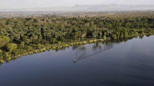
The Great Rift Valley runs through the country from north to south, and to the east of the valley lies Lake Malawi (also called Lake Nyasa), making up over three-quarters of Malawi's eastern boundary. Lake Malawi is sometimes called the Calendar Lake as it is about 365 miles (587 km) long and 52 miles (84 km) wide. Lake Malawi was “discovered” by the missionary-explorer Dr David Livingstone just over 150 years ago. Although totally landlocked, Malawi is not denied its “inland sea”. This vast body of freshwater fringed by beaches of golden sand is not only a scenic wonderland but it provides water sport opportunities for those looking for something beyond sun, sand and swimming.
The Shire River flows from the south end of the lake and joins the Zambezi River 250 miles (400 km) farther south in Mozambique. The surface of Lake Malawi is located at 1,500 feet (457 m) above sea level, with a maximum depth of 2,300 feet (701 m), which means the lake bottom is over 700 feet (213 m) below sea level at some points.
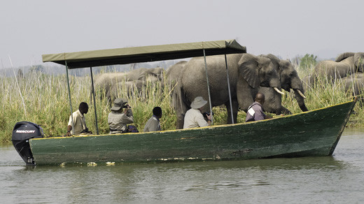
Malawi is blessed with a rich diversity of flora and fauna and has no less than nine National Parks or Wildlife Reserves. Whilst it may not have quite the sheer numbers of large mammals (particularly predators) as some of its better-known neighbours, it makes up for this in other ways. Malawi provides intensive and exclusive wildlife viewing in unspoilt areas of genuine wilderness.
Having a sundowner, unwinding in the glare of a sunset and hearing the sounds of singing birds and roaming game, Malawi is both a ...
Malawi Safari Tours & Holidays
Malawi is a landlocked country in southeast Africa that was formerly known as Nyasaland. It is bordered by Zambia to the northwest, Tanzania to the northeast, and Mozambique on the east, south and west. The country is separated from Tanzania and Mozambique by Lake Malawi.
The Great Rift Valley runs through the country from north to south, and to the east of the valley lies Lake Malawi (also called Lake Nyasa), making up over three-quarters of Malawi's eastern boundary. Lake Malawi is sometimes called the Calendar Lake as it is about 365 miles (587 km) long and 52 miles (84 km) wide. Lake Malawi was “discovered” by the missionary-explorer Dr David Livingstone just over 150 years ago. Although totally landlocked, Malawi is not denied its “inland sea”. This vast body of freshwater fringed by beaches of golden sand is not only a scenic wonderland but it provides water sport opportunities for those looking for something beyond sun, sand and swimming.
The Shire River flows from the south end of the lake and joins the Zambezi River 250 miles (400 km) farther south in Mozambique. The surface of Lake Malawi is located at 1,500 feet (457 m) above sea level, with a maximum depth of 2,300 feet (701 m), which means the lake bottom is over 700 feet (213 m) below sea level at some points.
Malawi is blessed with a rich diversity of flora and fauna and has no less than nine National Parks or Wildlife Reserves. Whilst it may not have quite the sheer numbers of large mammals (particularly predators) as some of its better-known neighbours, it makes up for this in other ways. Malawi provides intensive and exclusive wildlife viewing in unspoilt areas of genuine wilderness.
Having a sundowner, unwinding in the glare of a sunset and hearing the sounds of singing birds and roaming game, Malawi is both a country to relax in and a country to have adventure in.


